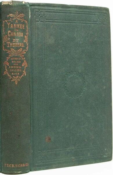
A Yankee in Canada: V – The Scenery of Quebec; and the River St. Lawrence
The Scenery of Quebec; and the River St. Lawrence
About twelve o’clock this day, being in the Lower Town, I looked up at the signal-gun by the flagstaff on Cape Diamond, and saw a soldier up in the heavens there making preparations to fire it—both he and the gun in bold relief against the sky. Soon after, being warned by the boom of the gun to look up again, there was only the cannon in the sky, the smoke just blowing away from it, as if the soldier, having touched it off, had concealed himself for effect, leaving the sound to echo grandly from shore to shore, and far up and down the river. This answered the purpose of a dinner-horn.
There are no such restaurateurs in Quebec or Montreal as there are in Boston. I hunted an hour or two in vain in this town to find one, till I lost my appetite. In one house, called a restaurateur, where lunches were advertised, I found only tables covered with bottles and glasses innumerable, containing apparently a sample of every liquid that has been known since the Earth dried up after the flood, but no scent of solid food did I perceive gross enough to excite a hungry mouse. In short, I saw nothing to tempt me there, but a large map of Canada against the wall. In another place I once more got as far as the bottles, and then asked for a bill of fare; was told to walk upstairs; had no bill of fare, nothing but fare. “Have you any pies or puddings?” I inquired, for I am obliged to keep my savageness in check by a low diet. “No, sir; we’ve nice muttonchop, roast beef, beefsteak, cutlets,” and so on. A burly Englishman, who was in the midst of the siege of a piece of roast beef, and of whom I have never had a front view to this day, turned half round, with his mouth half full, and remarked, “You’ll find no pies nor puddings in Quebec, sir; they don’t make any here.” I found that it was even so, and therefore bought some musty cake and some fruit in the open marketplace. This marketplace by the waterside, where the old women sat by their tables in the open air, amid a dense crowd jabbering all languages, was the best place in Quebec to observe the people; and the ferryboats, continually coming and going with their motley crews and cargoes, added much to the entertainment. I also saw them getting water from the river, for Quebec is supplied with water by cart and barrel. This city impressed me as wholly foreign and French, for I scarcely heard the sound of the English language in the streets. More than three fifths of the inhabitants are of French origin; and if the traveller did not visit the fortifications particularly, he might not be reminded that the English have any foothold here; and, in any case, if he looked no farther than Quebec, they would appear to have planted themselves in Canada only as they have in Spain at Gibraltar; and he who plants upon a rock cannot expect much increase. The novel sights and sounds by the waterside made me think of such ports as Boulogne, Dieppe, Rouen, and Havre de Grace, which I have never seen; but I have no doubt that they present similar scenes. I was much amused from first to last with the sounds made by the charette and caleche drivers. It was that part of their foreign language that you heard the most of—the French they talked to their horses—and which they talked the loudest. It was a more novel sound to me than the French of conversation. The streets resounded with the cries, “Qui donc!” “March tôt!” I suspect that many of our horses which came from Canada would prick up their ears at these sounds. Of the shops, I was most attracted by those where furs and Indian works were sold, as containing articles of genuine Canadian manufacture. I have been told that two townsmen of mine, who were interested in horticulture, travelling once in Canada, and being in Quebec, thought it would be a good opportunity to obtain seeds of the real Canada crookneck squash. So they went into a shop where such things were advertised, and inquired for the same. The shopkeeper had the very thing they wanted. “But are you sure,” they asked, “that these are the genuine Canada crookneck?” “O yes, gentlemen,” answered he, “they are a lot which I have received directly from Boston.” I resolved that my Canada crookneck seeds should be such as had grown in Canada.
Too much has not been said about the scenery of Quebec. The fortifications of Cape Diamond are omnipresent. They preside, they frown over the river and surrounding country. You travel ten, twenty, thirty miles up or down the river’s banks, you ramble fifteen miles amid the hills on either side, and then, when you have long since forgotten them, perchance slept on them by the way, at a turn of the road or of your body, there they are still, with their geometry against the sky. The child that is born and brought up thirty miles distant, and has never travelled to the city, reads his country’s history, sees the level lines of the citadel amid the cloud-built citadels in the western horizon, and is told that that is Quebec. No wonder if Jacques Cartier’s pilot exclaimed in Norman French, Que bec!—“What a beak!”—when he saw this cape, as some suppose. Every modern traveller involuntarily uses a similar expression. Particularly it is said that its sudden apparition on turning Point Levi makes a memorable impression on him who arrives by water. The view from Cape Diamond has been compared by European travellers with the most remarkable views of a similar kind in Europe, such as from Edinburgh Castle, Gibraltar, Cintra, and others, and preferred by many. A main peculiarity in this, compared with other views which I have beheld, is that it is from the ramparts of a fortified city, and not from a solitary and majestic river cape alone that this view is obtained. I associate the beauty of Quebec with the steel-like and flashing air, which may be peculiar to that season of the year, in which the blue flowers of the succory and some late goldenrods and buttercups on the summit of Cape Diamond were almost my only companions—the former bluer than the heavens they faced. Yet even I yielded in some degree to the influence of historical associations, and found it hard to attend to the geology of Cape Diamond or the botany of the Plains of Abraham. I still remember the harbor far beneath me, sparkling like silver in the sun—the answering highlands of Point Levi on the southeast—the frowning Cap Tourmente abruptly bounding the seaward view far in the northeast—the villages of Lorette and Charlesbourg on the north—and further west the distant Val Cartier, sparkling with white cottages, hardly removed by distance through the clear air—not to mention a few blue mountains along the horizon in that direction. You look out from the ramparts of the citadel beyond the frontiers of civilization. Yonder small group of hills, according to the guidebook, forms “the portal of the wilds which are trodden only by the feet of the Indian hunters as far as Hudson’s Bay.” It is but a few years since Bouchette declared that the country ten leagues north of the British capital of North America was as little known as the middle of Africa. Thus the citadel under my feet, and all historical associations, were swept away again by an influence from the wilds and from nature, as if the beholder had read her history—an influence which, like the Great River itself, flowed from the Arctic fastnesses and Western forests with irresistible tide over all.
The most interesting object in Canada to me was the River St. Lawrence, known far and wide, and for centuries, as the Great River. Cartier, its discoverer, sailed up it as far as Montreal in 1535—nearly a century before the coming of the Pilgrims; and I have seen a pretty accurate map of it so far, containing the city of “Hochelaga” and the river “Saguenay,” in Ortelius’s Theatrum Orbis Terrarum, printed at Antwerp in 1575—the first edition having appeared in 1570—in which the famous cities of “Norumbega” and “Orsinora” stand on the rough-blocked continent where New England is today, and the fabulous but unfortunate Isle of Demons, and Frislant, and others, lie off and on in the unfrequented sea, some of them prowling near what is now the course of the Cunard steamers. In this ponderous folio of the “Ptolemy of his age,” said to be the first general atlas published after the revival of the sciences in Europe, only one page of which is devoted to the topography of the Novus Orbis, the St. Lawrence is the only large river, whether drawn from fancy or from observation, on the east side of North America. It was famous in Europe before the other rivers of North America were heard of, notwithstanding that the mouth of the Mississippi is said to have been discovered first, and its stream was reached by Soto not long after; but the St. Lawrence had attracted settlers to its cold shores long before the Mississippi, or even the Hudson, was known to the world. Schoolcraft was misled by Gallatin into saying that Narvaez discovered the Mississippi. De Vega does not say so. The first explorers declared that the summer in that country was as warm as France, and they named one of the bays in the Gulf of St. Lawrence the Bay of Chaleur, or of warmth; but they said nothing about the winter being as cold as Greenland. In the manuscript account of Cartier’s second voyage, attributed by some to that navigator himself, it is called “the greatest river, without comparison, that is known to have ever been seen.” The savages told him that it was the “chemin du Canada”—the highway to Canada—“which goes so far that no man had ever been to the end that they had heard.” The Saguenay, one of its tributaries, which the panorama has made known to New England within three years, is described by Cartier, in 1535, and still more particularly by Jean Alphonse, in 1542, who adds, “I think that this river comes from the sea of Cathay, for in this place there issues a strong current, and there runs there a terrible tide.” The early explorers saw many whales and other sea-monsters far up the St. Lawrence. Champlain, in his map, represents a whale spouting in the harbor of Quebec, three hundred and sixty miles from what is called the mouth of the river; and Charlevoix takes his reader to the summit of Cape Diamond to see the “porpoises, white as snow,” sporting on the surface of the harbor of Quebec. And Boucher says in 1664, “from there (Tadoussac) to Montreal is found a great quantity of Marsouins blancs.” Several whales have been taken pretty high up the river since I was there. P. A. Gosse, in his Canadian Naturalist, p. 171 (London, 1840), speaks of “the white dolphin of the St. Lawrence (Delphinus canadensis)” as considered different from those of the sea. “The Natural History Society of Montreal offered a prize, a few years ago, for an essay on the cetacea of the St. Lawrence, which was, I believe, handed in.” In Champlain’s day it was commonly called “the Great River of Canada.” More than one nation has claimed it. In Ogilby’s America of 1670, in the map Novi Belgii, it is called “De Groote Rivier van Niew Nederlandt.” It bears different names in different parts of its course, as it flows through what were formerly the territories of different nations. From the Gulf to Lake Ontario it is called at present the St. Lawrence; from Montreal to the same place it is frequently called the Cateraqui; and higher up it is known successively as the Niagara, Detroit, St. Clair, St. Mary’s, and St. Louis rivers. Humboldt, speaking of the Orinoco, says that this name is unknown in the interior of the country; so likewise the tribes that dwell about the sources of the St. Lawrence have never heard the name which it bears in the lower part of its course. It rises near another father of waters—the Mississippi—issuing from a remarkable spring far up in the woods, called Lake Superior, fifteen hundred miles in circumference; and several other springs there are thereabouts which feed it. It makes such a noise in its tumbling down at one place as is heard all round the world. Bouchette, the Surveyor-General of the Canadas, calls it “the most splendid river on the globe”; says that it is two thousand statute miles long (more recent geographers make it four or five hundred miles longer); that at the Rivière du Sud it is eleven miles wide; at the Traverse, thirteen; at the Paps of Matane, twenty-five; at the Seven Islands, seventy-three; and at its mouth, from Cape Rosier to the Mingan Settlements in Labrador, near one hundred and five (?) miles wide. According to Captain Bayfield’s recent chart it is about ninety-six geographical miles wide at the latter place, measuring at right angles with the stream. It has much the largest estuary, regarding both length and breadth, of any river on the globe. Humboldt says that the river Plate, which has the broadest estuary of the South American rivers, is ninety-two geographical miles wide at its mouth; also he found the Orinoco to be more than three miles wide at five hundred and sixty miles from its mouth; but he does not tell us that ships of six hundred tons can sail up it so far, as they can up the St. Lawrence to Montreal—an equal distance. If he had described a fleet of such ships at anchor in a city’s port so far inland, we should have got a very different idea of the Orinoco. Perhaps Charlevoix describes the St. Lawrence truly as the most navigable river in the world. Between Montreal and Quebec it averages about two miles wide. The tide is felt as far up as Three Rivers, four hundred and thirty-two miles, which is as far as from Boston to Washington. As far up as Cap aux Oyes, sixty or seventy miles below Quebec, Kalm found a great part of the plants near the shore to be marine, as glasswort (Salicornia), seaside peas (Pisum maritimum), sea-milk wort (Glaux), beach-grass (Psamma arenarium), seaside plantain (Plantago maritima), the sea-rocket (Bunias cakile), etc.
The geographer Guyot observes that the Maranon is three thousand miles long, and gathers its waters from a surface of a million and a half square miles; that the Mississippi is also three thousand miles long, but its basin covers only from eight to nine hundred thousand square miles; that the St. Lawrence is eighteen hundred miles long, and its basin covers more than a million square miles (Darby says five hundred thousand); and speaking of the lakes, he adds, “These vast freshwater seas, together with the St. Lawrence, cover a surface of nearly one hundred thousand square miles, and it has been calculated that they contain about one half of all the fresh water on the surface of our planet.” But all these calculations are necessarily very rude and inaccurate. Its tributaries, the Ottawa, St. Maurice, and Saguenay, are great rivers themselves. The latter is said to be more than one thousand (?) feet deep at its mouth, while its cliffs rise perpendicularly an equal distance above its surface. Pilots say there are no soundings till one hundred and fifty miles up the St. Lawrence. The greatest sounding in the river, given on Bayfield’s chart of the gulf and river, is two hundred and twenty-eight fathoms. McTaggart, an engineer, observes that “the Ottawa is larger than all the rivers in Great Britain, were they running in one.” The traveller Grey writes: “A dozen Danubes, Rhines, Taguses, and Thameses would be nothing to twenty miles of fresh water in breadth (as where he happened to be), from ten to forty fathoms in depth.” And again: “There is not perhaps in the whole extent of this immense continent so fine an approach to it as by the river St. Lawrence. In the Southern States you have, in general, a level country for many miles inland; here you are introduced at once into a majestic scenery, where everything is on a grand scale—mountains, woods, lakes, rivers, precipices, waterfalls.”
We have not yet the data for a minute comparison of the St. Lawrence with the South American rivers; but it is obvious that, taking it in connection with its lakes, its estuary, and its falls, it easily bears off the palm from all the rivers on the globe; for though, as Bouchette observes, it may not carry to the ocean a greater volume of water than the Amazon and Mississippi, its surface and cubic mass are far greater than theirs. But, unfortunately, this noble river is closed by ice from the beginning of December to the middle of April. The arrival of the first vessel from England when the ice breaks up is, therefore, a great event, as when the salmon, shad, and alewives come up a river in the spring to relieve the famishing inhabitants on its banks. Who can say what would have been the history of this continent if, as has been suggested, this river had emptied into the sea where New York stands!
After visiting the Museum and taking one more look at the wall, I made haste to the Lord Sydenham steamer, which at five o’clock was to leave for Montreal. I had already taken a seat on deck, but finding that I had still an hour and a half to spare, and remembering that large map of Canada which I had seen in the parlor of the restaurateur in my search after pudding, and realizing that I might never see the like out of the country, I returned thither, asked liberty to look at the map, rolled up the mahogany table, put my handkerchief on it, stood on it, and copied all I wanted before the maid came in and said to me standing on the table, “Some gentlemen want the room, sir”; and I retreated without having broken the neck of a single bottle, or my own, very thankful and willing to pay for all the solid food I had got. We were soon abreast of Cap Rouge, eight miles above Quebec, after we got underway. It was in this place, then called “Fort du France Roy” that the Sieur de Roberval with his company, having sent home two of his three ships, spent the winter of 1542–43. It appears that they fared in the following manner (I translate from the original): “Each mess had only two loaves, weighing each a pound, and half a pound of beef. They ate pork for dinner, with half a pound of butter, and beef for supper, with about two handfuls of beans, without butter. Wednesdays, Fridays, and Saturdays they ate salted cod, and sometimes green, for dinner, with butter; and porpoise and beans for supper. Monsieur Roberval administered good justice, and punished each according to his offence. One, named Michel Gaillon, was hung for theft; John of Nantes was put in irons and imprisoned for his fault; and others were likewise put in irons; and many were whipped, both men and women; by which means they lived in peace and tranquillity.” In an account of a voyage up this river, printed in The Jesuit Relations in the year 1664, it is said: “It was an interesting navigation for us in ascending the river from Cap Tourment to Quebec, to see on this side and on that, for the space of eight leagues, the farms and the houses of the company, built by our French, all along these shores. On the right, the seigniories of Beauport, of Notre Dames des Anges; and on the left, this beautiful Isle of Orleans.” The same traveller names among the fruits of the country observed at the Isles of Richelieu, at the head of Lake St. Peter, “kinds (des espèces) of little apples or haws (semelles), and of pears, which only ripen with the frost.”
Night came on before we had passed the high banks. We had come from Montreal to Quebec in one night. The return voyage, against the stream, takes but an hour longer. Jacques Cartier, the first white man who is known to have ascended this river, thus speaks of his voyage from what is now Quebec to the foot of Lake St. Peter, or about halfway to Montreal: “From the said day, the 19th, even to the 28th of the said month, [September, 1535] we had been navigating up the said river without losing hour or day, during which time we had seen and found as much country and lands as level as we could desire, full of the most beautiful trees in the world,” which he goes on to describe. But we merely slept and woke again to find that we had passed through all that country which he was eight days in sailing through. He must have had a troubled sleep. We were not long enough on the river to realize that it had length; we got only the impression of its breadth, as if we had passed over a lake a mile or two in breadth and several miles long, though we might thus have slept through a European kingdom. Being at the head of Lake St. Peter, on the abovementioned 28th of September, dealing with the natives, Cartier says: “We inquired of them by signs if this was the route to Hochelaga [Montreal]; and they answered that it was, and that there were yet three days’ journeys to go there.” He finally arrived at Hochelaga on the 2nd of October.
When I went on deck at dawn we had already passed through Lake St. Peter, and saw islands ahead of us. Our boat advancing with a strong and steady pulse over the calm surface, we felt as if we were permitted to be awake in the scenery of a dream. Many vivacious Lombardy poplars along the distant shores gave them a novel and lively, though artificial, look, and contrasted strangely with the slender and graceful elms on both shores and islands. The church of Yarennes, fifteen miles from Montreal, was conspicuous at a great distance before us, appearing to belong to, and rise out of, the river; and now, and before, Mount Royal indicated where the city was. We arrived about seven o’clock, and set forth immediately to ascend the mountain, two miles distant, going across lots in spite of numerous signs threatening the severest penalties to trespassers, past an old building known as the Mac Tavish property—Simon Mac Tavish, I suppose, whom Silliman refers to as “in a sense the founder of the Northwestern Company.” His tomb was behind in the woods, with a remarkably high wall and higher monument. The family returned to Europe. He could not have imagined how dead he would be in a few years, and all the more dead and forgotten for being buried under such a mass of gloomy stone, where not even memory could get at him without a crowbar. Ah! poor man, with that last end of his! However, he may have been the worthiest of mortals for aught that I know. From the mountaintop we got a view of the whole city; the flat, fertile, extensive island; the noble sea of the St. Lawrence swelling into lakes; the mountains about St. Hyacinth, and in Vermont and New York; and the mouth of the Ottawa in the west, overlooking that St. Ann’s where the voyageur sings his “parting hymn,” and bids adieu to civilization—a name, thanks to Moore’s verses, the most suggestive of poetic associations of any in Canada. We, too, climbed the hill which Cartier, first of white men, ascended, and named Montreal, (the 3rd of October, O.S., 1535), and, like him, “we saw the said river as far as we could see, grand, large, et spacieux, going to the southwest,” toward that land whither Donnacona had told the discoverer that he had been a month’s journey from Canada, where there grew “force Canelle et Girofle,” much cinnamon and cloves, and where also, as the natives told him, were three great lakes and afterward une mer douce—a sweet sea—de laquelle n’est mention avoir vu le bout, of which there is no mention to have seen the end. But instead of an Indian town far in the interior of a new world, with guides to show us where the river came from, we found a splendid and bustling stone-built city of white men, and only a few squalid Indians offered to sell us baskets at the Lachine Railroad Depot, and Hochelaga is, perchance, but the fancy name of an engine company or an eating-house.
We left Montreal Wednesday, the 2nd of October, late in the afternoon. In the La Prairie cars the Yankees made themselves merry, imitating the cries of the charette-drivers to perfection, greatly to the amusement of some French-Canadian travellers, and they kept it up all the way to Boston. I saw one person on board the boat at St. John’s, and one or two more elsewhere in Canada, wearing homespun gray greatcoats, or capotes, with conical and comical hoods, which fell back between their shoulders like small bags, ready to be turned up over the head when occasion required, though a hat usurped that place now. They looked as if they would be convenient and proper enough as long as the coats were new and tidy, but would soon come to have a beggarly and unsightly look, akin to rags and dust-holes. We reached Burlington early in the morning, where the Yankees tried to pass off their Canada coppers, but the newsboys knew better. Returning through the Green Mountains, I was reminded that I had not seen in Canada such brilliant autumnal tints as I had previously seen in Vermont. Perhaps there was not yet so great and sudden a contrast with the summer heats in the former country as in these mountain valleys. As we were passing through Ashburnham, by a new white house which stood at some distance in a field, one passenger exclaimed, so that all in the car could hear him, “There, there’s not so good a house as that in all Canada!” I did not much wonder at his remark, for there is a neatness, as well as evident prosperity, a certain elastic easiness of circumstances, so to speak, when not rich, about a New England house, as if the proprietor could at least afford to make repairs in the spring, which the Canadian houses do not suggest. Though of stone, they are no better constructed than a stone barn would be with us; the only building, except the château, on which money and taste are expended, being the church. In Canada an ordinary New England house would be mistaken for the château, and while every village here contains at least several gentlemen or “squires,” there there is but one to a seigniory.
I got home this Thursday evening, having spent just one week in Canada and travelled eleven hundred miles. The whole expense of this journey, including two guidebooks and a map, which cost one dollar twelve and a half cents, was twelve dollars seventy-five cents. I do not suppose that I have seen all British America; that could not be done by a cheap excursion, unless it were a cheap excursion to the Icy Sea, as seen by Hearne or McKenzie, and then, no doubt, some interesting features would be omitted. I wished to go a little way behind that word Canadense, of which naturalists make such frequent use; and I should like still right well to make a longer excursion on foot through the wilder parts of Canada, which perhaps might be called Iter Canadense.

